Leonardo Da Vinci sketch now visible from outer space!
(click to enlarge)
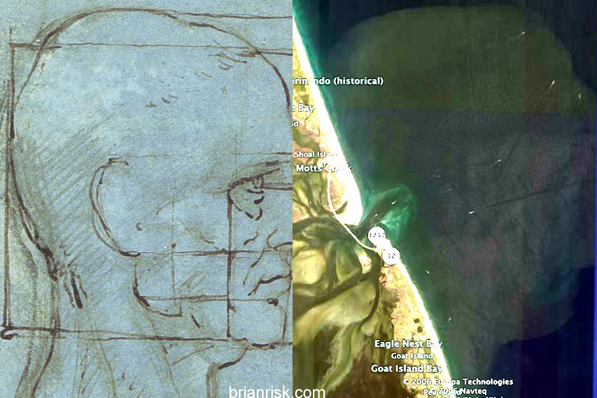
I think the first thing everyone does with Google Earth is to see if they can see their house. It’s sure as hell what I did. Then I explored my state, North Carolina, only to fince – BWAAAH! – a face pattern formed by silt entering the ocean of the Outer Banks. “Wait a minute,” I think, “I’ve seen that before!” A quick Google Image search revealed that yes-in-fucking-deed I had seen it before! Leonardo da Vinci wasn’t drawing old men profiles at all! He was clandestinely mapping the coast of North Carolina! He wanted our Tobacco!
Here is a link to the satellite image on Google Maps (or, if you prefer, the Google Earth KML file) and here is the original sketch.
Creepy, hunh? Better than the face on Mars, at least.